As America's leading source of
business charts, Davinci Business
Graphics is dedicated to providing
businesses with the tools they need
to be successful.


|
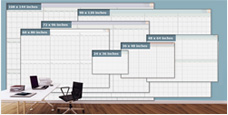
Large Chart Sizes
Get business charts for any size wall,
in sizes ranging from 3x4 to 9x12 feet!
|
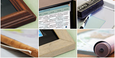
Finishing Options
Choose from laminated, mounted, framed and magnetic finishing
options
to fully display your business charts.
|
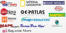
Leading Map Publishers
Leading Publishers - Get quality charts and maps from leading publishers,
and customize them by adding your business name & logo!
|